Ron LaughlinThe Ultimate New Zealand Travel Guide

Need Help? Contact me: my email
the Haast Area and North
(the drive up the lower West Coast)
(the drive up the lower West Coast)
The town of Haast is quite small. There is a super market there and in the area are some restaurants and motels. The World Heritage building has a great display worth stopping to see.
The Whitebaiter's Ball if you are there in September/October is the place to be. All the locals will be there and enjoying an evening of West Coast hospitality. This is white bait heaven in South Westland where every river has its banks lined this time of year with hardy folks with nets doing their best to fill them with the whitebait (to non-Kiwis it is a small fish considered a supreme delicacy) arriving from the ocean and heading up the many rivers. Be sure to try a whitebait sandwich.
If you take the road to Jackson’s Bay you will see some of the most elaborate huts and traps along the rivers you can imagine.
If you are coming south on route six you will be going through the Mt Aspiring National Park and crossing over the Southern Alps traveling along the Haast River over and into the Makaroa River valley and on to Wanaka.
Here is the video
Here is the West Coast route north to the Glaciers............
Heading north out of Hasst and up the West Coast on Route 6 you turn inland through swamp and rain forest with glimpses of the Tasman Sea here and there. It is more beautiful than it sounds. A very special place indeed.
Sixteen kilometres along at the Waitai River there is a large parking area as well as parking along Ship Creek. At this point the road starts up a hill where you will have a good outlook of the coastline. There are good pullover spots for photos.
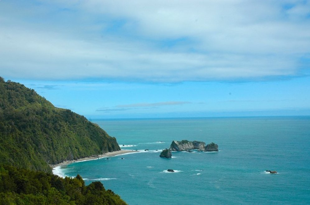
Another ten kilometres is Knights Point Lookout (above) and the first place to really stop and enjoy the wild coastline of the area. Plenty of room to park with a viewing platform and toilets. Commercial in appearance but still allows one to enjoy a spectacular view.
From here the road heads inland. Five kilometres along is Lake Moeraki. Several good pull off locations to stop and enjoy the view. Good pull offs after Boulder Creek and Cedar Creek.
18 kilometres along is a good place to stay at the DoC Camp on Lake Paringa. Beautiful lake where if you got a chance to cast a line for trout do so. Mt. Kinnaird at 1227 metres overlooks the area.
10 kilometers you find a salmon farm located at the edge of the Paringa River. You might want to see the gigantic salmon swimming in the round pools overlooked from the café and buy some fresh or smoked salmon.
On past is a good stopping spot at Doughboy Creek and a picnic spot on the Mahitahi River also. From this inland route now you head back toward the ocean at Bruce Bay (14 kms). A small community is located there and a great pull off area along the ocean. I remember my first experience with sand flies here in ’89. If you trod the beach be sure you have repellant. That’s true for the entire West Coast actually. You wonder why these fabulous beaches aren’t covered with condos?
On through Jacobs River where there is a place to park or picnic and across the Karangarua River (21 kms from Bruce Bay). Here is one of the most well known DoC tracks. Copland Track is on the right. Take the short road to the right to have a read about the place. If you are into tramping check this out before you get here and make arrangements with DoC. There is a toilet there.
From here you enter flat farm land for the next 27 kms to Fox Glacier. A gravel road to the right takes you to Fox Glacier parking area where a very short walk gains you access to the glacier for a closeup look. The town of Fox Glacier is just a short hop up the road north. Good coffee and food served at the Plateau Café & Bar in town.
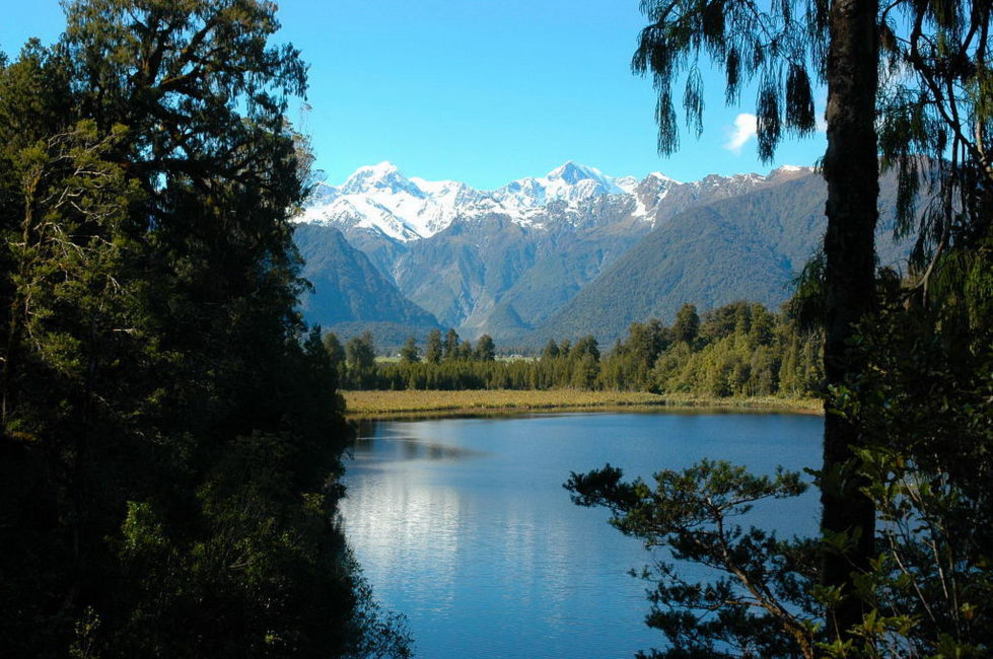
The best place on the coast to see the Southern Alps is down the Cooks Flat Road that ends up at Gillespies Beach. At the end of the hard top road before the gravel there is a stopping spot with the best view period if the weather permits. This is on past the turnoff to Lake Matheson also a place not to miss. If the weather is right do the walk around the lake. Worth the time and a very easy walk. Get a photo at the "View of Views" the one in all post cards of the area. Gillespies is 11 kms down the gravel road but is interesting for its history and offers a place to park.
After the exploration of this area lets head north for 23kms to the town of Franz Josef Glacier. Just before entering the main part of town to the right is a road just over the river that will take you to the foot of Franz Josef Glacier. This is a must. How many times in your life do you get to be that close to a glacier? You may want to take advantage of the many activities in the area such as a walk on the glacier, etc.
From here on north where we encounter 16 kms of steep winding road. Be sure to check your vehicle’s water before going on this trip. Spectacular views from the heights though of the Waiho River and the many mountain peaks inland. Several good pull offs for photos and views. Many creeks are crossed with names probably of the early miners such as Kiwi Jack and Smithy’s Creek.
Westland National Park lies between the road and the ocean. Lake Mapourika is on the left with a couple of good spots to park. Toilet available here and picnic tables. North end of lake is a giant parking area. Worth going out of Franz Josef this short distance to stop. You also will pass Lake Wahapo with also a place to pull off.
Knights Point Lookout
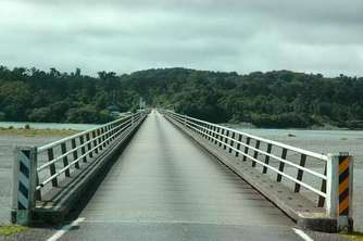
Haast River one-way bridge
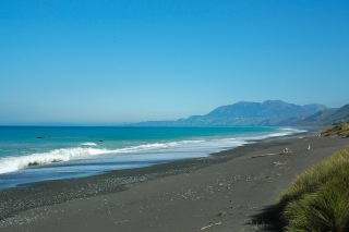
Bruce Bay
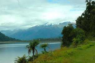
Lake Paringa
Lake Matheson