Ron Laughlin The Ultimate New Zealand Travel Guide

The South Island
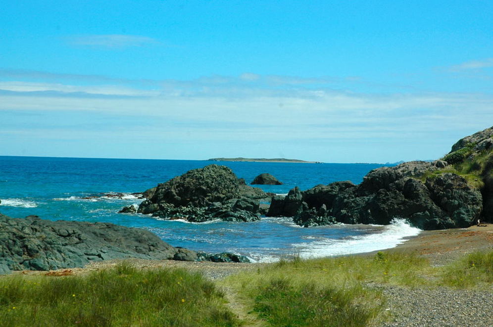
Riverton Rocks
Here are the regions: (I am in the process of re-building this page so it will not have the information
as required. Get one of my books and it is all there)
Marlborough Sounds -
Highway Six from Nelson and Highway One from Blenheim to Picton. There is great back road (sealed but winding) between Havelock and Picton through the Sounds. Also there are several roads into the Sounds but not really recommended for most visitors.
Fine weather throughout the Sounds in summer but can get very windy in the winter but still a very pleasant place to be.
The sea has made deep bays and filled valleys of what was once the northern portion of the Richmond Range of mountains from the rise of water after the ice ages plus the entire area seems to be continually tilting into Cook Strait.
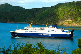
Captain Cook used it as his base. He discovered a good harbour that he named Queen Charlotte the location now known as Ship Cove. The Queen Charlotte Sound is one of two entries into the Sounds and the one that all ferries arrive or depart between the North and South Islands through the Tory Channel. The other is on northwest and is the Pelorus Sound where the Pelorus River flows into.
The entire Sounds is a boating dream with bays and inlets everywhere along with a generous dollop of small islands. In the area of Port Underwood was a whaling town in the late 1800’s known for its hell raising population all over the Pacific.
Heavy forest covers a great deal of the Sounds and wild pigs abound many descendants of those turned loose by Capt Cook. Much of the Sounds is reached by road but there are many homes scattered all over that can only be reached by boat. Picton and Havelock are the major towns of entry. Cook Strait dividing North and South Islands takes on the ferocity at times of the area it lies in called the Roaring Forties. Crossing at times can be upsetting with massive winds and strong currents.
Golden Bay and the Able Tasman National Park -
Highway 60 from Nelson and highway 6 from Westport are the roads to get to the Bay and to the Abel Tasman Park.
Golden Bay has a sunny, mild climate with light winds generally and a really pleasant spot. There is one road to this isolated area reached after a climb over the Takaka Hill or as it is mostly called “the Marble Mountain”.
The drive is very scenic and picturesque both going up and then down on the other side. The first glimpse of Golden Bay from the outlook at the top of the mountain shows a Shangri-la with rich farmland encompassed by mountains all the way around with the bay disappearing off into the mist of the sea toward Farewell Spit.
Great marble caves have been discovered along with rich and diverse plant and animal life which is one of the defining aspects of this special area.
The Able Tasman Park provides one of the best coastal playgrounds in New Zealand with golden sand beaches and wooded tracks perfect for boating, swimming, camping and walking.
The Park came into public controlled existence in 1942. Native forest has slowly begun to regenerate throughout the Park. For the adventuresome (not recommended for motor homes though we took our seven metre bus there) a dirt road on the top of Takaka Hill curves and jogs through marble and schist outcroppings and tussock to what is known as Cannaan Downs. At the end of the 11km road there is a short walk through the forest to Harwood’s Hole which drops 360 metres into the centre of the mountain.
Over 100 million years the Marble Mountain has had its depths carved by acid water into a honeycomb of caves and tunnels. April 2010 three cavers found the first 1 kilometre cave in New Zealand under Mt Arthur south of Nelson in the Ellis basin system that is 33.4km in length.
The Abel Tasman area is for adventuresome souls where white water boating, caving and wilderness travel are highlighted but it also provides plenty of places for the less adventuresome who want to visit scenic areas by car or short walks. In the Golden Bay area one of the top tracks for trampers is the Heaphy Track and the Mt Arthur Tableland.
The Heaphy Track is a 3 to 4 day walk of 70kms with comfortable huts not over 5 hours apart plus good bridges crossing all the major streams. The Tableland is a two day easy walk from Flora Saddle on the Motueka side to Cobb Road on the Golden Bay side.
IN 1862 James Mackay cut the track used today by modern trampers starting at the Aorere River in Golden Bay to the Heaphy River 11.5 kms north of Karamea on the West Coast. The track begins in beech forest then enters Gouland Downs an area of red tussock and multitudes of herbs and flowers with over 26 species of orchids along with lilies and daisies. 448 species of native plants have been found here many of them rare. From here the track is into valleys and forest becoming more tropical along the way leading into coastline.
There are several places worth visiting in the Golden Bay area such as Pupu Springs, one of the clearest springs in the world, the Te Anaroa Caves near Rockville, the Whanganui Inlet, Westhaven (up the Wairoa estuary at high tide by boat) and the Kaihoka Lakes Scenic Reserve but the one truly awesome spot to experience is Farewell Spit, a curve of sand 26kms long extending past the Centre where the road ends. There are excursions available out the Spit from Collingwood a really great place to stay when in the area.
This area is a migratory bird heaven with over 100 species been recorded. In March and April thousands of godwits start for their breeding grounds in the Siberian tundra, the longest migratory excursion in the world and returning in September. This sand spit was formed and continues to increase at the rate of 3 cubic metres a year from rock ground into sand by the glaciers and swept out to sea from the Southern Alps.
The Humpback whales in their migratory path north to their breeding grounds sometimes get stranded here.
Nelson Lakes National Park and the Buller River –
Access from the north is by route 6 from the Nelson area and route 63 from Blenheim. Pleasant summers with more rain in the western ranges. Through the Park runs the Alpine Fault, the western boundary of the Southern Alps, and to the east is the mountain range of St Anaud enclosing over 57000 hectares of land mostly mountainous country and forested valleys.
Lake Rotoroa and Lake Rotoiti formed by glacier and are enjoyed by everyone visiting the area. From Lake Rotoiti flows the Buller River for 170kms to the Tasman Sea on the West Coast and I consider it one of the most beautiful rivers I have seen.
Several easy walking tracks around Lake Rotoiti or perhaps the climb up Black Hill that takes about an hour or to the top of Mt Robert for the view. There is a road skirting the lake and goes to Robert’s Lookout. There is also a track along the Hukere River to Lake Angelus where there is a tramper’s hut.
There is a road (rough and narrow) coming off Route 6 at Gowan Bridge that goes along the Gowan River to Lake Rotoroa. From the Spenser Mountains the Sabine and Durville rivers feed Lake Rotoroa.
Lake Rotoroa is the place for visitors who want peace and quiet or perhaps a chance for a trout as it is considered one of the best lakes for fishing in the country. There are several tracks around Lake Rotoroa with the easiest being the Porika Track about a half day walk and the full day walk on the rougher Rotoroa Track but Lake Constance with mountain reflections is considered one of the most beautiful in the country and close by also of exquisite beauty is Blue Lake, surrounded by beech forest on the west branch of the Sabine River.
The Buller River named by the early European explorers, Brunner , Heaphy and Fox doesn’t quite fit as well as the Maori name I prefer of Kaatiri, meaning “swift and deep” which sums up this beautiful length of water.
At the junction of the Buller and Gowan rivers the waters flow aggressively through steep gorge for 75kms that can been seen from the road that parallels it a majority of the way to Murchison where it gentles down a bit.
Along this section of the river one can see the scars from the 1929 earthquake and at Inangahua it is worth a stop at the old building they have by the road that contains photos and information of the quake destruction then and in 1968.
Past here the river enters the Lower Buller Gorge also quite spectacular. The drive around Hawkes Crag is quite daunting as it is narrow and carved out of the vertical cliff face. The Buller River enters the Tasman Sea at Westport.
Ten kms to the west is Cape Foulwind where a walk to the lighthouse is well worth it. When you stop in the parking lot the local Weka are sure to check you out for a possible food source. This is one of New Zealand’s native birds that is visitor friendly and a delight to watch.
The Kaikouras
Route One from Picton to Christchurch is the main South Island road. Winds are light and the summers are warm but there are winter squalls. From Blenheim one passes through vineyards and the desolate hills until finally coming to the East Coast via route one.
As you get to the coast far to the left untouched by roads is Cape Campbell and from here the land rises and forms into two mountain ranges – the Seaward Kaikoura and the Inland Kaikouras. The Clarence River runs for over 70kms along a fault that separates the two ranges.
Also following a fault is the Awatere River and just north in parallel another fault rift has the Wairau River flowing. From the Clarence River south to just north of the Kaikoura Peninsula heavy rocky coast line and grey sand and rock beaches where giant kelp and seals call home and lobster fishing is at its finest. The towering mountains inland are impressive and have snow on their peaks most of the year.
The coast south of Kaikoura is quite rough and rocky with jagged reefs and large expanses of the giant kelp. Limestone caves named the Maori Leap Caves are just south of town filled with stalactites and stalagmites and the fossilized bones of seals and penguins.
This is the primary place to see and enjoy the seal colonies and the home to the whales either by boat or plane.
The Hurunui District by Vanessa Nelms
Hurunui is one of New Zealand's most stunning and spectacular regions located on the east coast of the South Island and an easy 45 minute drive north of Christchurch and its international airport.
Experience the irresistible charm of our towns and villages, superb wine and food at our cafés, restaurants and wineries, and a huge range of activities and attractions - there's plenty to do.
In Hurunui we live the lives others only dream of - come visit, and travel well.
Waipara - website
Just an easy 45 minute drive north from Christchurch nestled amongst the Teviotdale Hills you will find the Waipara Valley, one of New Zealand’s fastest growing wine regions.
A few years ago Master of Wine Bob Campbell called Waipara “one of the unsung heroes of the wine industry”.
Waipara wines now regularly take top honours at competition, especially Rieslings and Pinot Noirs, although some very good Sauvignon Blancs, Chardonnays, Pinot Gris and other varieties are finding their way onto discerning tables.
The wineries are currently producing more than 250,000 cases of wine each year and this number keeps growing. Warm summers with nor-west winds and sloping terrains harnesses the sun which provides ideal conditions for growing grapes.
Waipara has over 20 wineries and their summertime wine trail takes in eight cellar doors. Here you can drop in; taste wines and sometimes have a meal, a lunch platter or picnic amongst the vines. Other wineries invite tastings by appointment.
But Waipara is not all about wine... it can also boast some splendid scenic walks and wilderness trails, including the Mt Cass Walkway and Tiromoana Bush Walk (both tracks are closed for lambing through Sept). And for those who want to rewind the clock – take a ride on the historic Weka Pass Railway which operates every second Sunday and most public holidays.
The Mud House Winery & Cafe has built an enviable reputation for hosting top line International and Kiwi music acts in an excellent Waipara vineyard setting, some of the past entertainers have included Ronan Keating, Joe Cocker, Dave Dobbyn and Anika Moa.
Weka Pass Railway - http://www.wekapassrailway.co.nz/
The Weka Pass Railway is a historic rural railway using both vintage steam and diesel-electric locomotives on 12.8 km of scenic line through the unique limestone beauty of the Weka Pass out of Waipara.
The Weka Pass Railway is a totally voluntary organisation, whose members are dedicated to the preservation of New Zealand's rail heritage. Initially the railway runs across flat farm land and passes a large irrigation reservoir and vineyards, before it starts winding through the cuttings in the Pass.
Charles Upham Statue in Amberley - website
This bronze sculpture was crafted by Mark Whyte of Christchurch in 1997. It stands outside the Hurunui District Council buildings in Amberley, North Canterbury, New Zealand. The statue was unveiled on 10 December 1997 by the then Prime Minister of New Zealand, the Hon. Jenny Shipley. The statue depicts Charles Upham ‘the observer’, using the skill he practised in peace and war learnt while shepherding and mustering on the hill and high country properties of Island Hills, Glynn Wye, St Helens and Rata Downs.
Information provided by:
Vanessa Nelmes
Tourism Marketing Assistant - Hurunui Tourism
T +64 3 314 0057 | F +64 3 314 9181 | vanessa@visithurunui.co.nz
Hurunui Tourism, 66 Carters Rd, PO Box 13, Amberley 7441 www.visithurunui.co.nz
Arthur’s Pass National Park
Arthurs Pass is Highway 73 from Christchurch to route 6 to Kumara Junction south of Greymouth. Long periods of unsettled weather with strong westerly winds at times. Be aware of driving during winter with snow being a factor.
You can also catch a train ride also across from Christchurch and Greymouth is considered one of the world’s great train rides.
In 1865 it was decided to cut a road across to the West Coast as gold fever was upon the land. A thousand plus men through the bitterly cold alpine winter with only hand tools and explosives created a road in less than a year. Arthur’s Pass is the highest and most spectacular road crossing the Southern Alps. It is 160 kms from Springfield in the east to the old gold mining town of Kumara now but a crossroads.
A startling difference of vegetation with the east side of the Main Divide being forests of beech and on the west it is rainforest. Many a waterfall can be seen along this route.
The Craigieburn Range is ski country in the winter and beyond is Lake Pearson famous for its trout fishing and close by also is Lake Grassmere. The road follows the Waimakariri River that travels for 150kms to the Pacific Ocean.
This area has had four major periods of glaciers over 500,000 years and with erosion, raid, avalanche and earthquake this stark rugged country was formed.
In the upper Waimakairi can be found a tramper’s paradise. In a matter of just a few hours four huts can be reached. Glaciers are still to be found high in the river’s watershed. This is also a great area for mountaineer and climbers to tackle. There are over 16 mountains over 2000metres. Throughout the park also can be found the pesky bird, the kea, a parrot-like bird known for his curiosity and destruction of rubber auto trimmings such as around the window and the wiper blades.
Major earthquakes are still active in this area. The Taruahuna Pass is but a large pile of earthquake debris and in the Otehake Wilderness just beyond hot springs still merrily bubble.
This area of Edwards Valley has many good walking tracks. The Bealy Valley where the town of Arthurs Pass is located is the heart of the park. Less than a kilometre from the town is the location of a giant waterfall falling 150m named the Devils’ Punchbowl and nearby is the Bridal Veil waterfall.
If you cross the Pass in summer you will be rewarded on the west side with the beautiful flowering trees, the rata, with its scarlet flowers covering the slopes.
One of the major magic drives in New Zealand with the Otiri Gorge bridge being a spectacular man-made inclusion along the route.
Banks Peninsula –
A good sealed road is available from Christchurch Highway 75. Variable weather with cool summers and cold southerly gales bring snow to high levels.
It was named by Captain Cook in honour of his botanist, Sir Joseph Banks, who had been with him on his 1769-70 voyage. Banks Peninsula was formed by two volcanoes.
On the road to Akaroa on the right lies Lake Ellesmere a shallow coastal lake famous for its flounder and eel fishing and a population of thousands of black swans.
From the town of Little River one soon begins the circuitous drive up the mountain to reach the top for a scenic view of the town of Akaroa and the harbour.
The historic French town is the result of early French settlers who founded a colony there in 1840 but discovered the British had got there before them with a formal claim. They didn’t mind and stayed anyhow so today the town has the French charm of streets named Rue Lavaud, Rue Croix and more.
There is more to the Peninsula than Akaroa for those more adventuresome.
Take the Summit Road above Akaroa Harbour that goes on to the bush reserve of Otepatotu, 37 hectares of forest with a walking track 755m to the top of Lavericks Peak.
In the eastern bays there is Le Bons Bay and Okaines Bay where a small museum houses artifacts from the early Maori and pioneers to the region along with many walking tracks.
We enjoy Akaroa for its semi-isolation and great restaurants.
Mackenzie Country –
Highway 8 through the Mackenzie Country to route 80 into the National Park. This is the Southern Alps and the weather in the summer is fine but in the winter is heavy snow at times
The bare brown tussock world of the Mackenzie Basin is accessed from the east via the town of Fairlie. This is the beginning of the Mackenzie Country and access on route 8 from the south and from Central Otago through the awesome Lindis Pass to Omarama.
The three lakes of the region are Lake Tekapo, Lake Pukaki and Lake Ohau that provide the power for the hydro-electric stations and through canals to be stored at Lake Benmore for more power stations.
If you enter the area from route 83 you will pass through the length of hydro-electric lakes. The lakes were naturally created over 17.000 years ago being dammed by glacial moraine.
Several small lakes can be seen from the top of Mt John where the University of Pennsylvania has established an international observatory due to the clarity of the sky in this location. A great vista to drive up to and photograph.
Mount Cook National Park –
One of the major spots one must visit in New Zealand the area known as the Mackenzie Country inland southwest of Christchurch.
New Zealand’s highest mountain, Mount Cook (3764metres) and Tasman Glacier, longest glacier area in the park plus fourteen more peaks over 3000metres and four other glaciers with over 150 mountains over 2000metres. The park covers 70,000 hectares. The Maori name for Mt Cook is “Aorangi” meaning cloud in the sky.
Lake Pukaki and Lake Tekapo waters are of glacial beginnings and are of the cloudy light blue colour caused by the grinding force of the glaciers on the mountains creating what is known as rock flour.
Mountain climbers have been attacking Mount Cook since 1882. One being New Zealand’s world famous Edmund Hillary, who made history as the conqueror of Mt Everest in 1948. The first ascent was actually by another New Zealander, Tom Fyfe, in 1894.
The Tasman Glacier is one of the longest in the world 29 kms long and 3kms wide. From the Mt Cook Village there is a road to Blue Lakes and from there a short walk to the glacier terminal. From 13,000 years ago the glacier has been melting. Surveys show the ice is around 600metres thick at Ball Hut. The glacier provides top quality skiing also reached by ski-plane.
This mountainous area has a wild population of the chamois climbing through its heights from an original release back in 1907. The thar is also living in the region.
The Copland Pass at 2133metres separating the barren rocky eastern part of the Southern Alps to the western region of lush rainforests provides an accessible walking route over the Main Divide. It is a three to four day tramp with three huts available. Alpine tramping experience is required and Feb/March the best months to attempt it.
For those who wish a short trek of around three hours (11kms) start at the Mt Cook Village taking the Kea Point track into the Hooker Valley track taking you over two swing bridges above the Hooker River and close to the face of the Hooker Glacier.
The majority of New Zealand’s native plants grow exclusively in the mountainous areas and in the Mount Cook National park where there are over 400 species alone.
Westland National Park –
The West Coast is a narrow strip of land 238kms long from Greymouth to Haast with the Tasman Sea on the coastal side and the entire wall of the Southern Alps to the east where at certain intervals the mountain ranges border the sea.
The Westland National Park is 160kms of this area. Entry to this area is Route six all the way through the West Coast. The twelve rivers all begin in the mountains rushing wildly to the sea. Swamps and lakes are interspersed through the area with rain forest and glaciers being an integral part of the scenery. The warm current of the Tasman Sea keep the temperature on the coast from becoming too cold but it does have a tendency to be wet.
There is 24kms of steep winding road between Franz and Fox Glaciers. This is rainforest country………………so do expect it! If you want to go up the glaciers try to get there early is best.
Lake Mapourika is the largest lake in this region of 1813hectares having filled a hole left by a glacier. Lake Ianthe is surrounded by a matai forest that has a giant matai tree over 1000years old that is 5.3metres in girth. White herons and the royal spoonbill nest only in the Okarito Swamp here.
The Franz Josef Glacier is a mere 7000 years old and is 11kms long having advanced and receded many times in its life. It comes within 19kms of the coast. You can drive close to the terminal base to see it at that area where it feeds the Waiho River.
Several walks in this area such as just off the approach road is a five minute walk to the dramatic, clear Peters’ Pool. The Sentinel Rock walk is an easy walk to a scenic outlook of the glacier.
More fitness and time are required for the Robert’s Point Track and the hours trek to Lake Wombat. On this walk one can discover a plant hanging from the ferns, little hanging straps with tiny needles pointing down. This plant’s ancestors were common before modern plants 160 million years before dinosaurs.
The full days walk to Christmas Lookout requires good fitness and gear but worth it to be in the mountain meadow of alpine flowers in the summer.
Fox Glacier is 13kms long its base reached by a narrow road through forest for 5kms. The surface of the glacier has a pristine whiteness on its surface with the hollows create by water are a beautiful turquoise showing the criss-cross patterns created by the grinding action of constant movement. A track can be taken (with the right footwear) to the top of Mt Fox where panoramic views are fabulous as are the overlook of the glacier on the track up.
From Fox Glacier Village take the road to Gillespies Beach to Lake Matheson, the most scenic lake with the reflections of the Southern Alps providing a photographic quality especially early in the morning before the wind ruffles the water. It is an easy walk around the lake through the forest lined with ferns and moss and the joy of having the fluttering of fantails that come to chat at you and the sound of bellbirds rings through the canopy.
You can also take a branching track for 1 ½ hours to discover Lake Gault deep in the forest. This lake has most bird life around it and the view of the mountains is even more dramatic than Matheson.
To continue the road to Gillespies Beach will take you to an area that once was populated to the size of a small town during the gold rush (the gold found in the beach sand) from 1860 to 1890. A short walk around the area one can discover an old miner’s road and a tunnel and also a resident seal colony.
Travel on south on route 6 crossing over the Karangarua River and the western end of the Copland Track on south through forest lakes, river and swamps. One comes back to the ocean and the west coast beach at Bruce’s Bay, passing by the trout filled Lake Paringa and then Lake Moeraki and then coming back to the coastal lookout of Knight’s Point.
From here it is a roller coaster drive with swamp and trees closing in on the roadside until finally reaching the Callender-Hamilton bridge, the longest one-way bridge in New Zealand, over the Haast River.
Mount Aspiring National Park –
Continuing along Highway 6 it goes through the Park. It is a good chance it will be raining as you drive through. Not bad though as there are plenty of fabulous waterfalls to see then. I consider this one of the top drives of New Zealand.
Mount Aspiring, the Matterhorn of New Zealand, dominates the park at 3027metres second only to Mt Cook. The park was established in 1964 and stretched from the Haast River to the Humbolt Mountains by Lake Wakitiopu near Glenorchy. There is permanent snow above 2000metres.
One of the greatest ranges of alpine vegetation in the world between snow line and tree line is here with 94% of the vegetation found only in New Zealand. The Haast Pass is the lowest pass on the Main Divide.
It wasn’t until 1965 that the road was completed through to form this portion of route 6. It is 146kms from Haast Pass to Wanaka. To me this is one of the most dramatic drives in New Zealand.
On the western side it is wet with the mean annual rainfall recorded at Roaring Billy is 5840mm and rain falls on 182 days a year. One of the most dramatic scenic areas is at the Gates of Haast bridge where the Haast River plunges through giant schist boulders as it crashed down the mountain side.
Two kms south of the bridge is Thunder Falls where with just a 100meter walk through the beech forest brings you to the edge of the river and across from the 30 metre waterfall spectacular.
The whole area from the Olivine River to the Naihi River, 68 km to the north has been proclaimed as a wilderness area. The area of the Arawata and the Waiatoto rivers is some of the most remote inaccessible place in the country.
The Arawata river meets the sea northeast of Jackson’s Bay, settled since 1875, remotely reached by a road from the Haast area. It is a world of whitebaiting in the rivers of the area and also known for its lobster and paua.
Lake Wanaka/Lake Hawea -
Lake Wanaka is 45kms long and 4.8kms wide with its deepest point being 311metres. It is the source of the mighty southern river known as the Clutha.
Lake Hawea is 31kms long and 8km wide and a depth of 410m with its waters well stocked with trout and land-locked salmon.
Tracks -
The Rees-Dart track is marked, easily accessible and safer than many alpine tracks.
The Routburn track – This popular track can be accessed easily from either end from the Fiordland National Park by the Hollyford River or from the Routburn in the Mt Aspiring Park. There are several well placed huts along the walk first come first served November to May and only two nights.
Central Otago –
Highways 6 and 8 traverse Central Otago. Wanaka is linked with Queenstown also via the Crown Range - highway 89. This is the highest road in New Zealand closed in winter and not recommended any time. Rental vehicles are not allowed.
One of the most spectacular drives is from Queenstown to Cromwell on route 8 through the Kawarau Gorge. The climate is extreme with hot summers and cold winters and the lowest rainfall in the country.
A giant schist plateau rising over 600metres above the coastal area with the Dunstan Mountains, St Bathans and Hawkdun Ranges are the northern boundary to the Garvie and Umbrella Mountains to the south.
The area has the most popular tourist areas of Queenstown, Lake Wanaka, Lake Hawea and Lake Wakitipu within and Dunedin is at the southeast limit of the region.
Extreme weather from the hottest in the summer to the coldest in the winter is what to expect plus the dryness and the hills barren and arid.
Once upon as time less than 1500 years ago there was vegetation and forest but the early Moa hunters set fire to everything to drive the birds out to kill. Along with sheep grazing and unlimited amounts of rabbits the area has been totally denuded. Remoteness and desolation is what one finds with open blue skies that I actually find very beautiful in its starkness coupled with the solitude and open space. Pillars of rock 6-9metres high create a strange landscape in the Ida Valley and the Maniototo Plains.
In 1861 Gabriel Read discovered gold 5km out of the present town of Lawrence and the New Zealand gold rush began with over 11,000 prospecting for gold in just a couple of months in this area. Naseby was one of the early gold strike areas and today is where the sport of curling takes place.
The Roxburgh area is known for its fruit orchards. The original town of Cromwell was destroyed for the hydro lake all but a very small area now at the edge of Lake Dunstan and the present newly built Cromwell.
Beyond on the road to Queenstown area one drives along the Kawarau Gorge one of the most exciting drives in New Zealand. The Roaring Meg stream was named after a loud-mouthed redhead woman who tended a bar during the early gold mining days.
The towns of Clyde and Alexandra are both small towns of Central. The Clutha River, starting from Lake Wanaka, winds its way all the way to the Pacific through Central Otago and has an influence in its path. Central Otago wine is now being sought internationally for its quality especially the Pinot Noir.
The 800meter long and 50metres s deep Blue Lake at St Bathans was created in the search for gold…
Lake Wakitipu is 77kms long, 4.8kms at its widest and 378meters deep. At the junction of the south arm and the central arm of the lake lies Queenstown. The 50km drive to Glenorchy along the lake is one of the most scenic drives in the country. Just outside of Queenstown on the right a side road of 7kms takes you to the awesome Moke Lake DoC Camp one of our favourites to stay at.
Arrowtown came into being by gold discovery by William Fox in 1862 and is a fabulous small town to walk around plus a visit to the Chinese Village down by the river is recommended. You can also still find gold in the Arrow River.
The road to Wanaka over the Crown Range and via the Cadrona Valley is 70kms. The views are panoramic.
Lindis Gorge – (one of my favourite drives) is a linking road between Central Otago and the Mackenzie Basin through the Lindis Gorge via the Lindis Pass nestled between the Old Man Peak to the south and Longslip Mountain with Omarama 32kms to the northeast and Tarras 40 kms southwest. There is quite sparse vegetation with mostly tussock but the scenic value is extremely high.
Fiordland National Park –
The Milford Road is the only main road into the Park from Te Anau. It runs for 125kms through one of the most beautiful drives in the country. Even though you may be driving around New Zealand I recommend taking other transportation so you do not have to worry about the road and get the chance to really enjoy the scenic ride.
Fiordland is one of the wettest places in the country with unpredictable weather at all times. The extreme southeast of the South Island is the wettest, wildest and most isolated part of New Zealand. The valleys have broad, flat floors and almost vertical mountains. This area is greatly affected by the gales of the Roaring Forties.
The rainfall on an average at Milford Sound is 7274mm a year making Fordland one of the wettest places on earth. The land rises from south to north to the summit of the Darran Mountains.
The ice age ground out troughs and on the west coast these became the fiords and in the east lakes formed. Lake Te Anau is the largest lake in the South Island with a shoreline of over 500kms.
A half-hour trip from Te Anau to the base of the Murchison Mountains are the glow worm caves.
Deer farming sprang from the wild deer released in this region that once became so plentiful they had to be culled to protect the vegetation and over population. There is also Lake Manapouri said to be the most beautiful in New Zealand. A power project at the lake is probably one of the most interesting trips one van make in the region. Water is taken down vertically to turbines 213metres below lake level where it is discharged along a 10km tunnel and out to sea at Deep Cove.
The fiords exploitation began in the late 1700’s with the sealers and then the whalers followed by gold prospectors as late as in the early 1900’s.
When seals were almost exterminated and the whales became less and less and the gold veins petered out the fiords were left alone to be appreciated by explorers and lovers of nature. The Fordland crescent penguin breed only here.
The Milford Track is well known through the world by trampers. It is a three day hike for those who are fit and well prepared especially for the rain. One of the finest treats of the walk are the waterfalls such as the Sutherland Falls dropping over 580metres to the valley below, the fifth highest falls on earth and Giant Gate Falls considered the most beautiful.
Milford Sound –
Considered one of the great drives in the world is the one into Milford Sound. Passing the Mirror Lakes and on to the beautiful bush Hollyford Valley and on to the Homer Tunnel that was completed in 1953. The steep descent through the mountain with the tunnel dripping wet is an excursion on its own not so daunting now that there are lights in it. Then it emerges into the Cleddau Valley on many sharp curves of road to the valley below. One of the most photographed mountains in New Zealand is Mite Peak that forms the south wall of Milford Sound and reaching skyward to 1412 metres.
Looking down the Sounds from the parking lot and the Hotel beyond Mite Peak there is Bowen Falls and Mt Pembroke, the Lion and beyond id Sterling Falls.
In 1878 Donald Sutherland made this area his home and the present hotel stands where he began. A boat trip out through the Sounds takes you to the base of Sterling Falls which cascades directly into the sea and on to Anita Bay ad the Tasman Sea.
The Hollyford Track begins 8kms from Gunn’s Camp on the Hollyford River. The first day’s walk takes you to Hidden Falls on the river. Next day the track takes you along Bridal Falls after crossing the Little Homer Saddle. Guided walkers are picked up by jet boat and taken to a hut while those on their own have another 90 minutes to the public hut on the shores of Lake Alabaster and on to Lake McKerrow and along Demons Trail to the area once inhabited and known as Martins Bay.
The Catlins –
Sealed road now through the Catlins with highway 92 from Invercargill to Balclutha and highway One from Edendale. The climate is variable with shelter from the Southern Alps, low rainfall and constant summer sunshine with the winter storms bringing snow and sleet to low levels. One of New Zealand’s least known regions bordered by the sea between Invercargill and Balclutha with Owaka being the major small settlement of a few hundred. The forests were immense and in the early 1870s it was the busiest timber port in the country. Today the timber is long gone, the small farms were not prosperous leaving the area quiet. The Catlins State Forest Park protects what is left of the forest. One of the main landmarks is the lighthouse at Nugget Point and can be reached by leaving route 92 at Romahapa past Kaka Point. Seals and shore birds prevail on the rugged kelp fringed coastline. The Catlins is a natural place with virgin roan forests covering the hills along golden sand beaches scattered along broad estuaries and towering cliffs.
Cannibal Bay, named by early settlers after finding human bones there, can be reached by a road from route 92. It is a bay of broad sands for a kilometre and across the dunes is another beach at Surat Bay and the entrance of the Catlins River and upstream is the tidal Lake Catlins known for its sea-run trout. Close by is Jacks Bay with high cliffs and where the Tuhawaiki Island cliffs are honey-combed with little blue penguin burrows, sooty shearwaters and muttonbirds. Jack’s Blowhole a 55metre deep chasm at the end of a long tunnel is an interesting sight when the sea surges through at a roar.
From Ratanui the Takakopa Beach road leads to the Purakaunui Falls Reserve 500 hectares of native bush which has been preserved since 1905.
Studies have shown the Catlins were perhaps the last known area where giant flightless Moa existed.
South of Papatowai from Florence Hill one gets a panorama of the golden sand beach of Tautuku Bay. In this area is true dense green moss-hanging rain forest where except for the bird song all is quiet and peaceful. One of the roads that penetrate the forest goes to Waipati Beach Scenic Reserve and a 20 minute walk to the Cathedral Caves that are 30 metres high and reach into the cliffs more than 100 metres.
I recommend turning south along Waikawa Harbour and Porpoise bay to see the petrified forest at Curio Bay created 160 million years ago when a sub-tropical forest was overwhelmed by sand. At low tide you can see the now silica tree trunks up to 30 metres long.
Stewart Island –
Air service daily from Invercargill and ferry service from Bluff. Very changeable weather and the effect of the southerlies from the Antarctic are apparent. The least known and the least populated of the three main islands Stewart Island has remained largely a wilderness with exploration mostly on foot. The only settlement is Oban in Half-Moon Bay. The island itself is a part of the top of a large granite mass lying in the sea south of the island.
The island can be reached by a 20 minute air flight or the two hour boat ride from Bluff. The plant life shows its difference after 10,000 years of isolation. Many tracks available but the majority require experience and fitness. Early inhabitants were the sealer and whalers. This ia where the young of the sooty shearwater, known as mutton bird, are harvested each year this right being reserved for the descendents of the southern Maori who lived here when Steward Island was sold to the British.
The large Brown Kiwi can be observed here in the daytime. My wife tells the story about when her and her first husband lived a winter there in their sailboat in Glory Bay/Little Glory Bay. They were possum trappers for the fur in those days. Red deer were over abundant and upon occasion they would shoot one on the beach from the sailboat for food. There was also a salmon farm there and the local seals would terrorize it causing the salmon to scatter. So they had wonderful meals of venison and salmon whenever they wanted. Their excursions into the bush allowed them to observe the Brown Kiwi on many occasion during the day. The rare native ground parrot the kakapo lives o the island and is protected.
Some interesting history – In 1810 sealers came ashore near South Cape and were massacred with the exception of 16 year old James Caddell who for the next 12 years became a Maori in all aspects marrying the chief’s daughter and became a chief in his own right.
Check with Ron for an itinerary - email Ron
as required. Get one of my books and it is all there)
Marlborough Sounds -
Highway Six from Nelson and Highway One from Blenheim to Picton. There is great back road (sealed but winding) between Havelock and Picton through the Sounds. Also there are several roads into the Sounds but not really recommended for most visitors.
Fine weather throughout the Sounds in summer but can get very windy in the winter but still a very pleasant place to be.
The sea has made deep bays and filled valleys of what was once the northern portion of the Richmond Range of mountains from the rise of water after the ice ages plus the entire area seems to be continually tilting into Cook Strait.
Captain Cook used it as his base. He discovered a good harbour that he named Queen Charlotte the location now known as Ship Cove. The Queen Charlotte Sound is one of two entries into the Sounds and the one that all ferries arrive or depart between the North and South Islands through the Tory Channel. The other is on northwest and is the Pelorus Sound where the Pelorus River flows into.
The entire Sounds is a boating dream with bays and inlets everywhere along with a generous dollop of small islands. In the area of Port Underwood was a whaling town in the late 1800’s known for its hell raising population all over the Pacific.
Heavy forest covers a great deal of the Sounds and wild pigs abound many descendants of those turned loose by Capt Cook. Much of the Sounds is reached by road but there are many homes scattered all over that can only be reached by boat. Picton and Havelock are the major towns of entry. Cook Strait dividing North and South Islands takes on the ferocity at times of the area it lies in called the Roaring Forties. Crossing at times can be upsetting with massive winds and strong currents.
Golden Bay and the Able Tasman National Park -
Highway 60 from Nelson and highway 6 from Westport are the roads to get to the Bay and to the Abel Tasman Park.
Golden Bay has a sunny, mild climate with light winds generally and a really pleasant spot. There is one road to this isolated area reached after a climb over the Takaka Hill or as it is mostly called “the Marble Mountain”.
The drive is very scenic and picturesque both going up and then down on the other side. The first glimpse of Golden Bay from the outlook at the top of the mountain shows a Shangri-la with rich farmland encompassed by mountains all the way around with the bay disappearing off into the mist of the sea toward Farewell Spit.
Great marble caves have been discovered along with rich and diverse plant and animal life which is one of the defining aspects of this special area.
The Able Tasman Park provides one of the best coastal playgrounds in New Zealand with golden sand beaches and wooded tracks perfect for boating, swimming, camping and walking.
The Park came into public controlled existence in 1942. Native forest has slowly begun to regenerate throughout the Park. For the adventuresome (not recommended for motor homes though we took our seven metre bus there) a dirt road on the top of Takaka Hill curves and jogs through marble and schist outcroppings and tussock to what is known as Cannaan Downs. At the end of the 11km road there is a short walk through the forest to Harwood’s Hole which drops 360 metres into the centre of the mountain.
Over 100 million years the Marble Mountain has had its depths carved by acid water into a honeycomb of caves and tunnels. April 2010 three cavers found the first 1 kilometre cave in New Zealand under Mt Arthur south of Nelson in the Ellis basin system that is 33.4km in length.
The Abel Tasman area is for adventuresome souls where white water boating, caving and wilderness travel are highlighted but it also provides plenty of places for the less adventuresome who want to visit scenic areas by car or short walks. In the Golden Bay area one of the top tracks for trampers is the Heaphy Track and the Mt Arthur Tableland.
The Heaphy Track is a 3 to 4 day walk of 70kms with comfortable huts not over 5 hours apart plus good bridges crossing all the major streams. The Tableland is a two day easy walk from Flora Saddle on the Motueka side to Cobb Road on the Golden Bay side.
IN 1862 James Mackay cut the track used today by modern trampers starting at the Aorere River in Golden Bay to the Heaphy River 11.5 kms north of Karamea on the West Coast. The track begins in beech forest then enters Gouland Downs an area of red tussock and multitudes of herbs and flowers with over 26 species of orchids along with lilies and daisies. 448 species of native plants have been found here many of them rare. From here the track is into valleys and forest becoming more tropical along the way leading into coastline.
There are several places worth visiting in the Golden Bay area such as Pupu Springs, one of the clearest springs in the world, the Te Anaroa Caves near Rockville, the Whanganui Inlet, Westhaven (up the Wairoa estuary at high tide by boat) and the Kaihoka Lakes Scenic Reserve but the one truly awesome spot to experience is Farewell Spit, a curve of sand 26kms long extending past the Centre where the road ends. There are excursions available out the Spit from Collingwood a really great place to stay when in the area.
This area is a migratory bird heaven with over 100 species been recorded. In March and April thousands of godwits start for their breeding grounds in the Siberian tundra, the longest migratory excursion in the world and returning in September. This sand spit was formed and continues to increase at the rate of 3 cubic metres a year from rock ground into sand by the glaciers and swept out to sea from the Southern Alps.
The Humpback whales in their migratory path north to their breeding grounds sometimes get stranded here.
Nelson Lakes National Park and the Buller River –
Access from the north is by route 6 from the Nelson area and route 63 from Blenheim. Pleasant summers with more rain in the western ranges. Through the Park runs the Alpine Fault, the western boundary of the Southern Alps, and to the east is the mountain range of St Anaud enclosing over 57000 hectares of land mostly mountainous country and forested valleys.
Lake Rotoroa and Lake Rotoiti formed by glacier and are enjoyed by everyone visiting the area. From Lake Rotoiti flows the Buller River for 170kms to the Tasman Sea on the West Coast and I consider it one of the most beautiful rivers I have seen.
Several easy walking tracks around Lake Rotoiti or perhaps the climb up Black Hill that takes about an hour or to the top of Mt Robert for the view. There is a road skirting the lake and goes to Robert’s Lookout. There is also a track along the Hukere River to Lake Angelus where there is a tramper’s hut.
There is a road (rough and narrow) coming off Route 6 at Gowan Bridge that goes along the Gowan River to Lake Rotoroa. From the Spenser Mountains the Sabine and Durville rivers feed Lake Rotoroa.
Lake Rotoroa is the place for visitors who want peace and quiet or perhaps a chance for a trout as it is considered one of the best lakes for fishing in the country. There are several tracks around Lake Rotoroa with the easiest being the Porika Track about a half day walk and the full day walk on the rougher Rotoroa Track but Lake Constance with mountain reflections is considered one of the most beautiful in the country and close by also of exquisite beauty is Blue Lake, surrounded by beech forest on the west branch of the Sabine River.
The Buller River named by the early European explorers, Brunner , Heaphy and Fox doesn’t quite fit as well as the Maori name I prefer of Kaatiri, meaning “swift and deep” which sums up this beautiful length of water.
At the junction of the Buller and Gowan rivers the waters flow aggressively through steep gorge for 75kms that can been seen from the road that parallels it a majority of the way to Murchison where it gentles down a bit.
Along this section of the river one can see the scars from the 1929 earthquake and at Inangahua it is worth a stop at the old building they have by the road that contains photos and information of the quake destruction then and in 1968.
Past here the river enters the Lower Buller Gorge also quite spectacular. The drive around Hawkes Crag is quite daunting as it is narrow and carved out of the vertical cliff face. The Buller River enters the Tasman Sea at Westport.
Ten kms to the west is Cape Foulwind where a walk to the lighthouse is well worth it. When you stop in the parking lot the local Weka are sure to check you out for a possible food source. This is one of New Zealand’s native birds that is visitor friendly and a delight to watch.
The Kaikouras
Route One from Picton to Christchurch is the main South Island road. Winds are light and the summers are warm but there are winter squalls. From Blenheim one passes through vineyards and the desolate hills until finally coming to the East Coast via route one.
As you get to the coast far to the left untouched by roads is Cape Campbell and from here the land rises and forms into two mountain ranges – the Seaward Kaikoura and the Inland Kaikouras. The Clarence River runs for over 70kms along a fault that separates the two ranges.
Also following a fault is the Awatere River and just north in parallel another fault rift has the Wairau River flowing. From the Clarence River south to just north of the Kaikoura Peninsula heavy rocky coast line and grey sand and rock beaches where giant kelp and seals call home and lobster fishing is at its finest. The towering mountains inland are impressive and have snow on their peaks most of the year.
The coast south of Kaikoura is quite rough and rocky with jagged reefs and large expanses of the giant kelp. Limestone caves named the Maori Leap Caves are just south of town filled with stalactites and stalagmites and the fossilized bones of seals and penguins.
This is the primary place to see and enjoy the seal colonies and the home to the whales either by boat or plane.
The Hurunui District by Vanessa Nelms
Hurunui is one of New Zealand's most stunning and spectacular regions located on the east coast of the South Island and an easy 45 minute drive north of Christchurch and its international airport.
Experience the irresistible charm of our towns and villages, superb wine and food at our cafés, restaurants and wineries, and a huge range of activities and attractions - there's plenty to do.
In Hurunui we live the lives others only dream of - come visit, and travel well.
Waipara - website
Just an easy 45 minute drive north from Christchurch nestled amongst the Teviotdale Hills you will find the Waipara Valley, one of New Zealand’s fastest growing wine regions.
A few years ago Master of Wine Bob Campbell called Waipara “one of the unsung heroes of the wine industry”.
Waipara wines now regularly take top honours at competition, especially Rieslings and Pinot Noirs, although some very good Sauvignon Blancs, Chardonnays, Pinot Gris and other varieties are finding their way onto discerning tables.
The wineries are currently producing more than 250,000 cases of wine each year and this number keeps growing. Warm summers with nor-west winds and sloping terrains harnesses the sun which provides ideal conditions for growing grapes.
Waipara has over 20 wineries and their summertime wine trail takes in eight cellar doors. Here you can drop in; taste wines and sometimes have a meal, a lunch platter or picnic amongst the vines. Other wineries invite tastings by appointment.
But Waipara is not all about wine... it can also boast some splendid scenic walks and wilderness trails, including the Mt Cass Walkway and Tiromoana Bush Walk (both tracks are closed for lambing through Sept). And for those who want to rewind the clock – take a ride on the historic Weka Pass Railway which operates every second Sunday and most public holidays.
The Mud House Winery & Cafe has built an enviable reputation for hosting top line International and Kiwi music acts in an excellent Waipara vineyard setting, some of the past entertainers have included Ronan Keating, Joe Cocker, Dave Dobbyn and Anika Moa.
Weka Pass Railway - http://www.wekapassrailway.co.nz/
The Weka Pass Railway is a historic rural railway using both vintage steam and diesel-electric locomotives on 12.8 km of scenic line through the unique limestone beauty of the Weka Pass out of Waipara.
The Weka Pass Railway is a totally voluntary organisation, whose members are dedicated to the preservation of New Zealand's rail heritage. Initially the railway runs across flat farm land and passes a large irrigation reservoir and vineyards, before it starts winding through the cuttings in the Pass.
Charles Upham Statue in Amberley - website
This bronze sculpture was crafted by Mark Whyte of Christchurch in 1997. It stands outside the Hurunui District Council buildings in Amberley, North Canterbury, New Zealand. The statue was unveiled on 10 December 1997 by the then Prime Minister of New Zealand, the Hon. Jenny Shipley. The statue depicts Charles Upham ‘the observer’, using the skill he practised in peace and war learnt while shepherding and mustering on the hill and high country properties of Island Hills, Glynn Wye, St Helens and Rata Downs.
Information provided by:
Vanessa Nelmes
Tourism Marketing Assistant - Hurunui Tourism
T +64 3 314 0057 | F +64 3 314 9181 | vanessa@visithurunui.co.nz
Hurunui Tourism, 66 Carters Rd, PO Box 13, Amberley 7441 www.visithurunui.co.nz
Arthur’s Pass National Park
Arthurs Pass is Highway 73 from Christchurch to route 6 to Kumara Junction south of Greymouth. Long periods of unsettled weather with strong westerly winds at times. Be aware of driving during winter with snow being a factor.
You can also catch a train ride also across from Christchurch and Greymouth is considered one of the world’s great train rides.
In 1865 it was decided to cut a road across to the West Coast as gold fever was upon the land. A thousand plus men through the bitterly cold alpine winter with only hand tools and explosives created a road in less than a year. Arthur’s Pass is the highest and most spectacular road crossing the Southern Alps. It is 160 kms from Springfield in the east to the old gold mining town of Kumara now but a crossroads.
A startling difference of vegetation with the east side of the Main Divide being forests of beech and on the west it is rainforest. Many a waterfall can be seen along this route.
The Craigieburn Range is ski country in the winter and beyond is Lake Pearson famous for its trout fishing and close by also is Lake Grassmere. The road follows the Waimakariri River that travels for 150kms to the Pacific Ocean.
This area has had four major periods of glaciers over 500,000 years and with erosion, raid, avalanche and earthquake this stark rugged country was formed.
In the upper Waimakairi can be found a tramper’s paradise. In a matter of just a few hours four huts can be reached. Glaciers are still to be found high in the river’s watershed. This is also a great area for mountaineer and climbers to tackle. There are over 16 mountains over 2000metres. Throughout the park also can be found the pesky bird, the kea, a parrot-like bird known for his curiosity and destruction of rubber auto trimmings such as around the window and the wiper blades.
Major earthquakes are still active in this area. The Taruahuna Pass is but a large pile of earthquake debris and in the Otehake Wilderness just beyond hot springs still merrily bubble.
This area of Edwards Valley has many good walking tracks. The Bealy Valley where the town of Arthurs Pass is located is the heart of the park. Less than a kilometre from the town is the location of a giant waterfall falling 150m named the Devils’ Punchbowl and nearby is the Bridal Veil waterfall.
If you cross the Pass in summer you will be rewarded on the west side with the beautiful flowering trees, the rata, with its scarlet flowers covering the slopes.
One of the major magic drives in New Zealand with the Otiri Gorge bridge being a spectacular man-made inclusion along the route.
Banks Peninsula –
A good sealed road is available from Christchurch Highway 75. Variable weather with cool summers and cold southerly gales bring snow to high levels.
It was named by Captain Cook in honour of his botanist, Sir Joseph Banks, who had been with him on his 1769-70 voyage. Banks Peninsula was formed by two volcanoes.
On the road to Akaroa on the right lies Lake Ellesmere a shallow coastal lake famous for its flounder and eel fishing and a population of thousands of black swans.
From the town of Little River one soon begins the circuitous drive up the mountain to reach the top for a scenic view of the town of Akaroa and the harbour.
The historic French town is the result of early French settlers who founded a colony there in 1840 but discovered the British had got there before them with a formal claim. They didn’t mind and stayed anyhow so today the town has the French charm of streets named Rue Lavaud, Rue Croix and more.
There is more to the Peninsula than Akaroa for those more adventuresome.
Take the Summit Road above Akaroa Harbour that goes on to the bush reserve of Otepatotu, 37 hectares of forest with a walking track 755m to the top of Lavericks Peak.
In the eastern bays there is Le Bons Bay and Okaines Bay where a small museum houses artifacts from the early Maori and pioneers to the region along with many walking tracks.
We enjoy Akaroa for its semi-isolation and great restaurants.
Mackenzie Country –
Highway 8 through the Mackenzie Country to route 80 into the National Park. This is the Southern Alps and the weather in the summer is fine but in the winter is heavy snow at times
The bare brown tussock world of the Mackenzie Basin is accessed from the east via the town of Fairlie. This is the beginning of the Mackenzie Country and access on route 8 from the south and from Central Otago through the awesome Lindis Pass to Omarama.
The three lakes of the region are Lake Tekapo, Lake Pukaki and Lake Ohau that provide the power for the hydro-electric stations and through canals to be stored at Lake Benmore for more power stations.
If you enter the area from route 83 you will pass through the length of hydro-electric lakes. The lakes were naturally created over 17.000 years ago being dammed by glacial moraine.
Several small lakes can be seen from the top of Mt John where the University of Pennsylvania has established an international observatory due to the clarity of the sky in this location. A great vista to drive up to and photograph.
Mount Cook National Park –
One of the major spots one must visit in New Zealand the area known as the Mackenzie Country inland southwest of Christchurch.
New Zealand’s highest mountain, Mount Cook (3764metres) and Tasman Glacier, longest glacier area in the park plus fourteen more peaks over 3000metres and four other glaciers with over 150 mountains over 2000metres. The park covers 70,000 hectares. The Maori name for Mt Cook is “Aorangi” meaning cloud in the sky.
Lake Pukaki and Lake Tekapo waters are of glacial beginnings and are of the cloudy light blue colour caused by the grinding force of the glaciers on the mountains creating what is known as rock flour.
Mountain climbers have been attacking Mount Cook since 1882. One being New Zealand’s world famous Edmund Hillary, who made history as the conqueror of Mt Everest in 1948. The first ascent was actually by another New Zealander, Tom Fyfe, in 1894.
The Tasman Glacier is one of the longest in the world 29 kms long and 3kms wide. From the Mt Cook Village there is a road to Blue Lakes and from there a short walk to the glacier terminal. From 13,000 years ago the glacier has been melting. Surveys show the ice is around 600metres thick at Ball Hut. The glacier provides top quality skiing also reached by ski-plane.
This mountainous area has a wild population of the chamois climbing through its heights from an original release back in 1907. The thar is also living in the region.
The Copland Pass at 2133metres separating the barren rocky eastern part of the Southern Alps to the western region of lush rainforests provides an accessible walking route over the Main Divide. It is a three to four day tramp with three huts available. Alpine tramping experience is required and Feb/March the best months to attempt it.
For those who wish a short trek of around three hours (11kms) start at the Mt Cook Village taking the Kea Point track into the Hooker Valley track taking you over two swing bridges above the Hooker River and close to the face of the Hooker Glacier.
The majority of New Zealand’s native plants grow exclusively in the mountainous areas and in the Mount Cook National park where there are over 400 species alone.
Westland National Park –
The West Coast is a narrow strip of land 238kms long from Greymouth to Haast with the Tasman Sea on the coastal side and the entire wall of the Southern Alps to the east where at certain intervals the mountain ranges border the sea.
The Westland National Park is 160kms of this area. Entry to this area is Route six all the way through the West Coast. The twelve rivers all begin in the mountains rushing wildly to the sea. Swamps and lakes are interspersed through the area with rain forest and glaciers being an integral part of the scenery. The warm current of the Tasman Sea keep the temperature on the coast from becoming too cold but it does have a tendency to be wet.
There is 24kms of steep winding road between Franz and Fox Glaciers. This is rainforest country………………so do expect it! If you want to go up the glaciers try to get there early is best.
Lake Mapourika is the largest lake in this region of 1813hectares having filled a hole left by a glacier. Lake Ianthe is surrounded by a matai forest that has a giant matai tree over 1000years old that is 5.3metres in girth. White herons and the royal spoonbill nest only in the Okarito Swamp here.
The Franz Josef Glacier is a mere 7000 years old and is 11kms long having advanced and receded many times in its life. It comes within 19kms of the coast. You can drive close to the terminal base to see it at that area where it feeds the Waiho River.
Several walks in this area such as just off the approach road is a five minute walk to the dramatic, clear Peters’ Pool. The Sentinel Rock walk is an easy walk to a scenic outlook of the glacier.
More fitness and time are required for the Robert’s Point Track and the hours trek to Lake Wombat. On this walk one can discover a plant hanging from the ferns, little hanging straps with tiny needles pointing down. This plant’s ancestors were common before modern plants 160 million years before dinosaurs.
The full days walk to Christmas Lookout requires good fitness and gear but worth it to be in the mountain meadow of alpine flowers in the summer.
Fox Glacier is 13kms long its base reached by a narrow road through forest for 5kms. The surface of the glacier has a pristine whiteness on its surface with the hollows create by water are a beautiful turquoise showing the criss-cross patterns created by the grinding action of constant movement. A track can be taken (with the right footwear) to the top of Mt Fox where panoramic views are fabulous as are the overlook of the glacier on the track up.
From Fox Glacier Village take the road to Gillespies Beach to Lake Matheson, the most scenic lake with the reflections of the Southern Alps providing a photographic quality especially early in the morning before the wind ruffles the water. It is an easy walk around the lake through the forest lined with ferns and moss and the joy of having the fluttering of fantails that come to chat at you and the sound of bellbirds rings through the canopy.
You can also take a branching track for 1 ½ hours to discover Lake Gault deep in the forest. This lake has most bird life around it and the view of the mountains is even more dramatic than Matheson.
To continue the road to Gillespies Beach will take you to an area that once was populated to the size of a small town during the gold rush (the gold found in the beach sand) from 1860 to 1890. A short walk around the area one can discover an old miner’s road and a tunnel and also a resident seal colony.
Travel on south on route 6 crossing over the Karangarua River and the western end of the Copland Track on south through forest lakes, river and swamps. One comes back to the ocean and the west coast beach at Bruce’s Bay, passing by the trout filled Lake Paringa and then Lake Moeraki and then coming back to the coastal lookout of Knight’s Point.
From here it is a roller coaster drive with swamp and trees closing in on the roadside until finally reaching the Callender-Hamilton bridge, the longest one-way bridge in New Zealand, over the Haast River.
Mount Aspiring National Park –
Continuing along Highway 6 it goes through the Park. It is a good chance it will be raining as you drive through. Not bad though as there are plenty of fabulous waterfalls to see then. I consider this one of the top drives of New Zealand.
Mount Aspiring, the Matterhorn of New Zealand, dominates the park at 3027metres second only to Mt Cook. The park was established in 1964 and stretched from the Haast River to the Humbolt Mountains by Lake Wakitiopu near Glenorchy. There is permanent snow above 2000metres.
One of the greatest ranges of alpine vegetation in the world between snow line and tree line is here with 94% of the vegetation found only in New Zealand. The Haast Pass is the lowest pass on the Main Divide.
It wasn’t until 1965 that the road was completed through to form this portion of route 6. It is 146kms from Haast Pass to Wanaka. To me this is one of the most dramatic drives in New Zealand.
On the western side it is wet with the mean annual rainfall recorded at Roaring Billy is 5840mm and rain falls on 182 days a year. One of the most dramatic scenic areas is at the Gates of Haast bridge where the Haast River plunges through giant schist boulders as it crashed down the mountain side.
Two kms south of the bridge is Thunder Falls where with just a 100meter walk through the beech forest brings you to the edge of the river and across from the 30 metre waterfall spectacular.
The whole area from the Olivine River to the Naihi River, 68 km to the north has been proclaimed as a wilderness area. The area of the Arawata and the Waiatoto rivers is some of the most remote inaccessible place in the country.
The Arawata river meets the sea northeast of Jackson’s Bay, settled since 1875, remotely reached by a road from the Haast area. It is a world of whitebaiting in the rivers of the area and also known for its lobster and paua.
Lake Wanaka/Lake Hawea -
Lake Wanaka is 45kms long and 4.8kms wide with its deepest point being 311metres. It is the source of the mighty southern river known as the Clutha.
Lake Hawea is 31kms long and 8km wide and a depth of 410m with its waters well stocked with trout and land-locked salmon.
Tracks -
The Rees-Dart track is marked, easily accessible and safer than many alpine tracks.
The Routburn track – This popular track can be accessed easily from either end from the Fiordland National Park by the Hollyford River or from the Routburn in the Mt Aspiring Park. There are several well placed huts along the walk first come first served November to May and only two nights.
Central Otago –
Highways 6 and 8 traverse Central Otago. Wanaka is linked with Queenstown also via the Crown Range - highway 89. This is the highest road in New Zealand closed in winter and not recommended any time. Rental vehicles are not allowed.
One of the most spectacular drives is from Queenstown to Cromwell on route 8 through the Kawarau Gorge. The climate is extreme with hot summers and cold winters and the lowest rainfall in the country.
A giant schist plateau rising over 600metres above the coastal area with the Dunstan Mountains, St Bathans and Hawkdun Ranges are the northern boundary to the Garvie and Umbrella Mountains to the south.
The area has the most popular tourist areas of Queenstown, Lake Wanaka, Lake Hawea and Lake Wakitipu within and Dunedin is at the southeast limit of the region.
Extreme weather from the hottest in the summer to the coldest in the winter is what to expect plus the dryness and the hills barren and arid.
Once upon as time less than 1500 years ago there was vegetation and forest but the early Moa hunters set fire to everything to drive the birds out to kill. Along with sheep grazing and unlimited amounts of rabbits the area has been totally denuded. Remoteness and desolation is what one finds with open blue skies that I actually find very beautiful in its starkness coupled with the solitude and open space. Pillars of rock 6-9metres high create a strange landscape in the Ida Valley and the Maniototo Plains.
In 1861 Gabriel Read discovered gold 5km out of the present town of Lawrence and the New Zealand gold rush began with over 11,000 prospecting for gold in just a couple of months in this area. Naseby was one of the early gold strike areas and today is where the sport of curling takes place.
The Roxburgh area is known for its fruit orchards. The original town of Cromwell was destroyed for the hydro lake all but a very small area now at the edge of Lake Dunstan and the present newly built Cromwell.
Beyond on the road to Queenstown area one drives along the Kawarau Gorge one of the most exciting drives in New Zealand. The Roaring Meg stream was named after a loud-mouthed redhead woman who tended a bar during the early gold mining days.
The towns of Clyde and Alexandra are both small towns of Central. The Clutha River, starting from Lake Wanaka, winds its way all the way to the Pacific through Central Otago and has an influence in its path. Central Otago wine is now being sought internationally for its quality especially the Pinot Noir.
The 800meter long and 50metres s deep Blue Lake at St Bathans was created in the search for gold…
Lake Wakitipu is 77kms long, 4.8kms at its widest and 378meters deep. At the junction of the south arm and the central arm of the lake lies Queenstown. The 50km drive to Glenorchy along the lake is one of the most scenic drives in the country. Just outside of Queenstown on the right a side road of 7kms takes you to the awesome Moke Lake DoC Camp one of our favourites to stay at.
Arrowtown came into being by gold discovery by William Fox in 1862 and is a fabulous small town to walk around plus a visit to the Chinese Village down by the river is recommended. You can also still find gold in the Arrow River.
The road to Wanaka over the Crown Range and via the Cadrona Valley is 70kms. The views are panoramic.
Lindis Gorge – (one of my favourite drives) is a linking road between Central Otago and the Mackenzie Basin through the Lindis Gorge via the Lindis Pass nestled between the Old Man Peak to the south and Longslip Mountain with Omarama 32kms to the northeast and Tarras 40 kms southwest. There is quite sparse vegetation with mostly tussock but the scenic value is extremely high.
Fiordland National Park –
The Milford Road is the only main road into the Park from Te Anau. It runs for 125kms through one of the most beautiful drives in the country. Even though you may be driving around New Zealand I recommend taking other transportation so you do not have to worry about the road and get the chance to really enjoy the scenic ride.
Fiordland is one of the wettest places in the country with unpredictable weather at all times. The extreme southeast of the South Island is the wettest, wildest and most isolated part of New Zealand. The valleys have broad, flat floors and almost vertical mountains. This area is greatly affected by the gales of the Roaring Forties.
The rainfall on an average at Milford Sound is 7274mm a year making Fordland one of the wettest places on earth. The land rises from south to north to the summit of the Darran Mountains.
The ice age ground out troughs and on the west coast these became the fiords and in the east lakes formed. Lake Te Anau is the largest lake in the South Island with a shoreline of over 500kms.
A half-hour trip from Te Anau to the base of the Murchison Mountains are the glow worm caves.
Deer farming sprang from the wild deer released in this region that once became so plentiful they had to be culled to protect the vegetation and over population. There is also Lake Manapouri said to be the most beautiful in New Zealand. A power project at the lake is probably one of the most interesting trips one van make in the region. Water is taken down vertically to turbines 213metres below lake level where it is discharged along a 10km tunnel and out to sea at Deep Cove.
The fiords exploitation began in the late 1700’s with the sealers and then the whalers followed by gold prospectors as late as in the early 1900’s.
When seals were almost exterminated and the whales became less and less and the gold veins petered out the fiords were left alone to be appreciated by explorers and lovers of nature. The Fordland crescent penguin breed only here.
The Milford Track is well known through the world by trampers. It is a three day hike for those who are fit and well prepared especially for the rain. One of the finest treats of the walk are the waterfalls such as the Sutherland Falls dropping over 580metres to the valley below, the fifth highest falls on earth and Giant Gate Falls considered the most beautiful.
Milford Sound –
Considered one of the great drives in the world is the one into Milford Sound. Passing the Mirror Lakes and on to the beautiful bush Hollyford Valley and on to the Homer Tunnel that was completed in 1953. The steep descent through the mountain with the tunnel dripping wet is an excursion on its own not so daunting now that there are lights in it. Then it emerges into the Cleddau Valley on many sharp curves of road to the valley below. One of the most photographed mountains in New Zealand is Mite Peak that forms the south wall of Milford Sound and reaching skyward to 1412 metres.
Looking down the Sounds from the parking lot and the Hotel beyond Mite Peak there is Bowen Falls and Mt Pembroke, the Lion and beyond id Sterling Falls.
In 1878 Donald Sutherland made this area his home and the present hotel stands where he began. A boat trip out through the Sounds takes you to the base of Sterling Falls which cascades directly into the sea and on to Anita Bay ad the Tasman Sea.
The Hollyford Track begins 8kms from Gunn’s Camp on the Hollyford River. The first day’s walk takes you to Hidden Falls on the river. Next day the track takes you along Bridal Falls after crossing the Little Homer Saddle. Guided walkers are picked up by jet boat and taken to a hut while those on their own have another 90 minutes to the public hut on the shores of Lake Alabaster and on to Lake McKerrow and along Demons Trail to the area once inhabited and known as Martins Bay.
The Catlins –
Sealed road now through the Catlins with highway 92 from Invercargill to Balclutha and highway One from Edendale. The climate is variable with shelter from the Southern Alps, low rainfall and constant summer sunshine with the winter storms bringing snow and sleet to low levels. One of New Zealand’s least known regions bordered by the sea between Invercargill and Balclutha with Owaka being the major small settlement of a few hundred. The forests were immense and in the early 1870s it was the busiest timber port in the country. Today the timber is long gone, the small farms were not prosperous leaving the area quiet. The Catlins State Forest Park protects what is left of the forest. One of the main landmarks is the lighthouse at Nugget Point and can be reached by leaving route 92 at Romahapa past Kaka Point. Seals and shore birds prevail on the rugged kelp fringed coastline. The Catlins is a natural place with virgin roan forests covering the hills along golden sand beaches scattered along broad estuaries and towering cliffs.
Cannibal Bay, named by early settlers after finding human bones there, can be reached by a road from route 92. It is a bay of broad sands for a kilometre and across the dunes is another beach at Surat Bay and the entrance of the Catlins River and upstream is the tidal Lake Catlins known for its sea-run trout. Close by is Jacks Bay with high cliffs and where the Tuhawaiki Island cliffs are honey-combed with little blue penguin burrows, sooty shearwaters and muttonbirds. Jack’s Blowhole a 55metre deep chasm at the end of a long tunnel is an interesting sight when the sea surges through at a roar.
From Ratanui the Takakopa Beach road leads to the Purakaunui Falls Reserve 500 hectares of native bush which has been preserved since 1905.
Studies have shown the Catlins were perhaps the last known area where giant flightless Moa existed.
South of Papatowai from Florence Hill one gets a panorama of the golden sand beach of Tautuku Bay. In this area is true dense green moss-hanging rain forest where except for the bird song all is quiet and peaceful. One of the roads that penetrate the forest goes to Waipati Beach Scenic Reserve and a 20 minute walk to the Cathedral Caves that are 30 metres high and reach into the cliffs more than 100 metres.
I recommend turning south along Waikawa Harbour and Porpoise bay to see the petrified forest at Curio Bay created 160 million years ago when a sub-tropical forest was overwhelmed by sand. At low tide you can see the now silica tree trunks up to 30 metres long.
Stewart Island –
Air service daily from Invercargill and ferry service from Bluff. Very changeable weather and the effect of the southerlies from the Antarctic are apparent. The least known and the least populated of the three main islands Stewart Island has remained largely a wilderness with exploration mostly on foot. The only settlement is Oban in Half-Moon Bay. The island itself is a part of the top of a large granite mass lying in the sea south of the island.
The island can be reached by a 20 minute air flight or the two hour boat ride from Bluff. The plant life shows its difference after 10,000 years of isolation. Many tracks available but the majority require experience and fitness. Early inhabitants were the sealer and whalers. This ia where the young of the sooty shearwater, known as mutton bird, are harvested each year this right being reserved for the descendents of the southern Maori who lived here when Steward Island was sold to the British.
The large Brown Kiwi can be observed here in the daytime. My wife tells the story about when her and her first husband lived a winter there in their sailboat in Glory Bay/Little Glory Bay. They were possum trappers for the fur in those days. Red deer were over abundant and upon occasion they would shoot one on the beach from the sailboat for food. There was also a salmon farm there and the local seals would terrorize it causing the salmon to scatter. So they had wonderful meals of venison and salmon whenever they wanted. Their excursions into the bush allowed them to observe the Brown Kiwi on many occasion during the day. The rare native ground parrot the kakapo lives o the island and is protected.
Some interesting history – In 1810 sealers came ashore near South Cape and were massacred with the exception of 16 year old James Caddell who for the next 12 years became a Maori in all aspects marrying the chief’s daughter and became a chief in his own right.
Check with Ron for an itinerary - email Ron
and here are the towns......
Akaroa
Alexandra & Central
Arrowtown
Arthurs Pass
Ashburton
Blenheim
Buller/Murchison
Catlins
Christchurch
Dunedin
Geraldine
Hanmer Springs
Havelock
Invercargill
Kaikoura
Lawrence
Lewis Pass
Mackenzie Country
Moeraki
Nelson
Oamaru
Picton
Queenstown
Reefton
Te Anau/Fiordland
Timaru
Wanaka
West Coast -
Blackball
Denniston
Glaciers
Greymouth
Karamea
Haast area
Hokitika
Westport
Beach in the Catlins
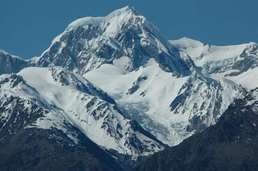
Glacier
Interislander